Inscrivez-vous maintenant pour un meilleur devis personnalisé!


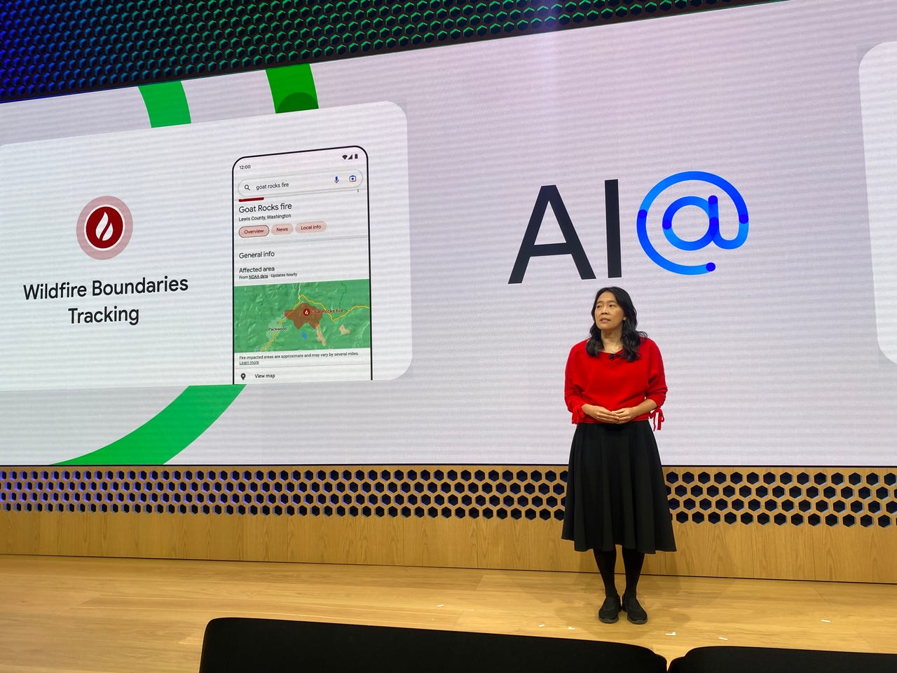
At a Google AI Keynote event in NYC, Katherine Chou, senior director for Google Research, talks about Google's wildfire tracking technology.
Image: Sabrina Ortiz/Google is helping people combat the negative effects of climate change, including extreme weather patterns such as wildfires and floods, by developing tracking systems for these natural disasters.
On Wednesday, Google added new features to its flood and wildfire tracking services that expand the scope of who can use it and what it does.
Google's wildfire tracking system has already covered more than 30 big wildfire events in the US and Canada in real time, helping alert both community members and firefighting teams, with over seven million views, according to a blog post.
Source: GoogleGoogle has expanded its wildfire tracking systems to identify and track wildfires in real time and predict how they will evolve and spread. The tech giant has accomplished these changes by advancing its use of satellite imagery to train the AI models.
The tracking system will now also be present in other parts of the world, including parts of Australia and Mexico. Australia can benefit greatly from this type of technology as it is prone to wildfires and is still recovering from the record-breaking wildfires it experienced two years ago.
Also: Google makes massive commitment to support more languages using AI
Google also has a flood tracking system in place that helps predict when floods will occur and how deep the water will be. In 2021, Google sent 115 million flood alert notifications to 23 million people, according to the post.
Now the coverage will expand to countries in South America, Sub-Saharan Africa and South Asia, adding up to coverage in 18 additional nations. Using an AI technique called transfer learning has allowed Google to make the flood tracking work in areas where there's less data available.
Google also launched FloodHub, a new platform that displays where and when floods might occur on a world map. The FloodHub map provides the same flood information that flood tracking provides but displays it in a more visual way.
Source: GoogleUsing FloodHub, you can also zoom into specific areas and find hyper-local information, such as flood data for villages.
 Tags chauds:
affaires
Les entreprises
Tags chauds:
affaires
Les entreprises
Inscrivez-vous par courriel maintenant pour le Stock de Promotion hebdomadaire
100% free, Unsubscribe any time!
Add 1: Room 605 6/F FA YUEN Commercial Building, 75-77 FA YUEN Street, Mongkok KL, HongKong Add 2: Room 405, Building E, MeiDu Building, Gong Shu District, Hangzhou City, Zhejiang Province, China
Whatsapp/Tel: +8618057156223 Tél. : + 33 (0) 3 88 88 20: 0086 571 86729517 Tel à HK: 00852 66181601
Courriel:: [email protected]
 English
 Pусский
 Français
 Español
 Português